A Rochester Bridge Trust-supported project has brought to life the transport networks and geography of England and Wales during the late 1400s.
Funded partly by a grant from the Trust, David Harrison used exhaustive scholarly research and real-life exploration to reconstruct the road map of the country at the time, complete with points of interest such as castles, monasteries and inns.
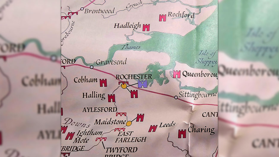
The detailed, colourful map deliberately recalls surviving medieval maps such as the Gough Map in its visual style, including decorations. It has been published as a large, single sheet map until the title ‘Historic Ways Road Map of England and Wales in the Late Middle Ages’, along with some information about what it was like for the medieval traveller.
Travelling in the medieval period was not easy, with journey times often measured in days and few travel modes open to road users except horses and going on foot. Waypoints and signage were later inventions, meaning travellers had to use a mixture of directions, landmarks and guides to find their way across the country.
In the late 1400s the road network was also at the centre of the Wars of the Roses, a series of civil wars lasting from the 1450s to the 1480s, carrying rival armies to bloody battles and sieges.
Despite the difficulties and dangers of travelling, merchants, market sellers, nobles and religious pilgrims were all on the move.
Meanwhile, what would become the Rochester Bridge Trust was already looking after its own vital crossing across the River Medway.
David Harrison’s ‘Historic Ways Road Map of England and Wales in the Late Middle Ages’, is available online from Waterstones.
You can read more about the map on the website for the British Archaeological Association
For more information about our grant-making, see our Grants page.